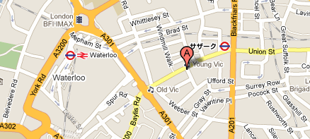
Looking at Google Maps today I noticed that close to Waterloo station is a station that now has it's name in Japanese.
Is it just my browser or should I have another go at learning Japanese to help me navigate the tube network?
http://maps.google.com/maps?f=q&source=s...14334&z=16
It reads sazaku which makes no sense to me.
That's Southwark, close enough

Still in Japanese (if that's what it is) today. But at least if you click on it it comes up 'Southwark' and gives info about the station in English. Very strange glitch - or is our Underground network being infiltrated?

I also had places on Google's London map coming up in French and German. Would love to think Google are doing an international week, but a browser problem is more likely.

That would be Sasuwaruku for Southwark.
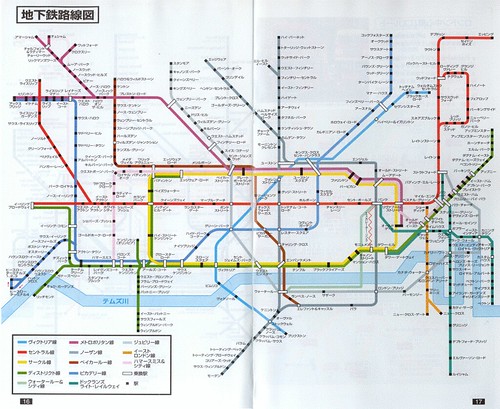
For a more consistent approach to the underground system there is a ?????????? available.
That would be Sasuwaruku for Southwark.
Agreed if you were translating every syllable including acknowledging the ones that are lurking there silently.
I think that the translator(s) have opted for the spelling closest to the actual pronunciation.
The "thw" is silent in local pronunciation, don't you think? If so, then Sazaaku feels like it is following this.
Based on my growing up in Tokyo I would say mine was closest

. Having said that it was a long while ago so I wont swear to it.
...I would say mine was closest.
Yes. On reflection an Interpreter may go with the pronunciation, which I was doing, and the Translator would go with the literal which it seems you translated. On maps I'd go with translating every single letter without regard to pronunciation like you have done. Well done.
I lived in Shinjuku in the late 1970's and early 1980's. Where were you?
I was in Shinagawa-ku or Meguro no mai from 76 to 81. Loved Japan and continued to go back even after I was sent "home" to South Africa to go to boarding school as the schooling (at my school anyway) in Japan was a little lax.
On Google Maps if you type in Forest Hill station, we appear to have an Underground, Overground and National Rail station!
Perhaps this is unsurprising given the confusion about whether the Overgound is a National Rail or Underground service. I haven't checked every station down the line but most seem to be the same as Forest Hill. Strangely Penge West is only National Rail though!
The only thing I can think of is Google receive the tube map data from TfL and they think it's a dual branded service, alas the orange and red roundel logos.
The Penge West lack of roundel is baffling as it's clearly on the tube map.
When the ELL initially opened, the core stations (Surrey Quays-Dalston Junction) had NR logos instead of roundels on Google Maps.
Google Maps is having a load of language/localisation issues at the moment. I've seen French tags all over the London map, and a few Dutch ones too. Not sure what the problem is.
On the same note, Google also seems to regularly locate HOP somewhere along the A20 between New Cross and Lewisham, when typing in SE23 on the map. The location name disappears when magnifying the map, just as well...
I know it's a little left-field for this thread, but has anyone seen
this digital version of London? I know google also does something similar, but this is a bit better IMHO.